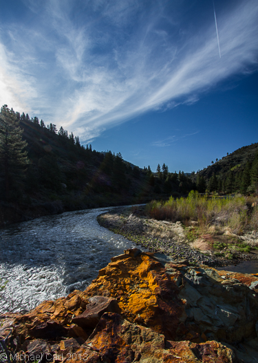

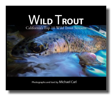
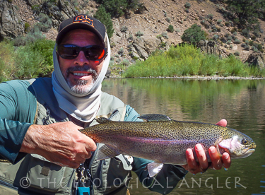
 The East Fork Carson River below Hangman's Bridge is featured in the new ebook, Wild Trout.
 Look for my photography in the January / February issue of American Fly Fishing.
You'll learn more about the wild and stocked trout fisheries of the East Fork of the Carson River.
Look for my photography in the January / February issue of American Fly Fishing.
You'll learn more about the wild and stocked trout fisheries of the East Fork of the Carson River.
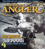 Look for my feature article - Secrets of the Sierras 4 Classic Walk-In Trips appearingin the current May/June issue of American Angler.
You'll learn more about the wild trout fisheries of the East Fork of the Carson River.
From Sacramento Drive east on U.S. 50 to the junction with Highway 89. Turn south on Highway 89 and drive over Luther Pass to the junction with Highway 88. Turn left and drive to Woodfords and Highway 89. Turn right onto Highway 89 and drive throught the town of Markleeville. Proceed six miles and the river will come into view below the road and to the left. Access from the highway and just pass the first bridge that crosses the river (called Hangman's Bridge).
From Stockton Take Highway 4 east over Ebbetts Pass (Warning: this stretch is long, narrow, and curvy) to the juntion with Highway 89. Turn left. The river will be in view to the left. Plently of direct access is available along Highway 89.
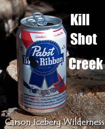
California's Department of Fish & Game is leveling a kill shot at Silver King Creek - a major trib to the East Fork of the Carson River. The EcoAngler visits this water before the planned removal of the non-natives.
The Carson River basin encompasses almost 4,000 square miles in California and Nevada. The Carson basin is south of Lake Tahoe and north of the Walker River. The Carson's headwaters are in the Sierra Nevada and flow eastward to drain into the marshes of the Stillwater National Wildlife Refuge. Eventually the water terminates into the Carson Sink. Roughly eighty-five percent of the watershed lands are in Nevada. However, some of the prime trout water is located near the headwaters in California.

The East Fork of the Carson has a long and varied history of fish stocking going back as far 1879. It's a dark history when you consider the fact that Lahontan cutthroat inhabitated some 300 miles throughout the Carson drainage including the East Fork. Today no self-sustaining Lahontan populations can be found on the East Fork below Carson Falls.
The last fish stocking of the segment between Hangman's Bridge and the Nevada stateline happened in 1988. C.D.F.&G. released about 10,000 brown trout fingerlings into a two mile stretch of the river below Hangman's Bridge. The survival of the trout was not high. Prior to the planting, the section averaged 400 brown trout in the > 6 inch age class during the 1987 survey. The following years survery produced only 416 in the same class group. Today, the dominant species in the East Fork looks to be rainbows.
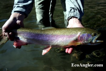
In my recent trips to the East Fork I have not netted a single brown trout. (Today fish plants continue to happen upstream of Hangman's bridge and below the confluence with Wolf Creek). Over the years, the hold overs from the earlier plants have grown nicely with several rainbows holding in larger pools over 20 inches.
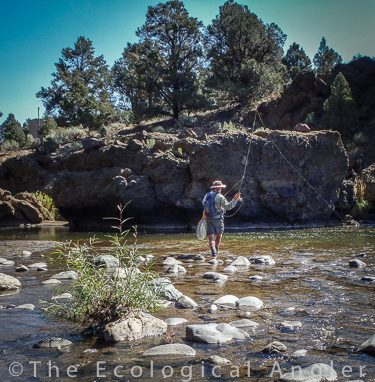
A portion of the east fork, from the town of Markleeville downstream to the state line, is included in California's wild and scenic river system. Some of the upper segments (e.g., below Hangman's bridge) are designated as wild-trout waters and special regulations apply. Please refer to California DFG's Regulations for further details. As with other high elevation streams, it's important to know the current and prior flows when fishing the East Fork of the Carson River.