

Look for my article on the Upper Middle Fork San Joaquin River in the July/August 2017 issue of Southwest Fly Fishing
 The Upper Middle Fork of the San Joaquin River is featured in the new ebook, Wild Trout.
From Mammoth Lakes
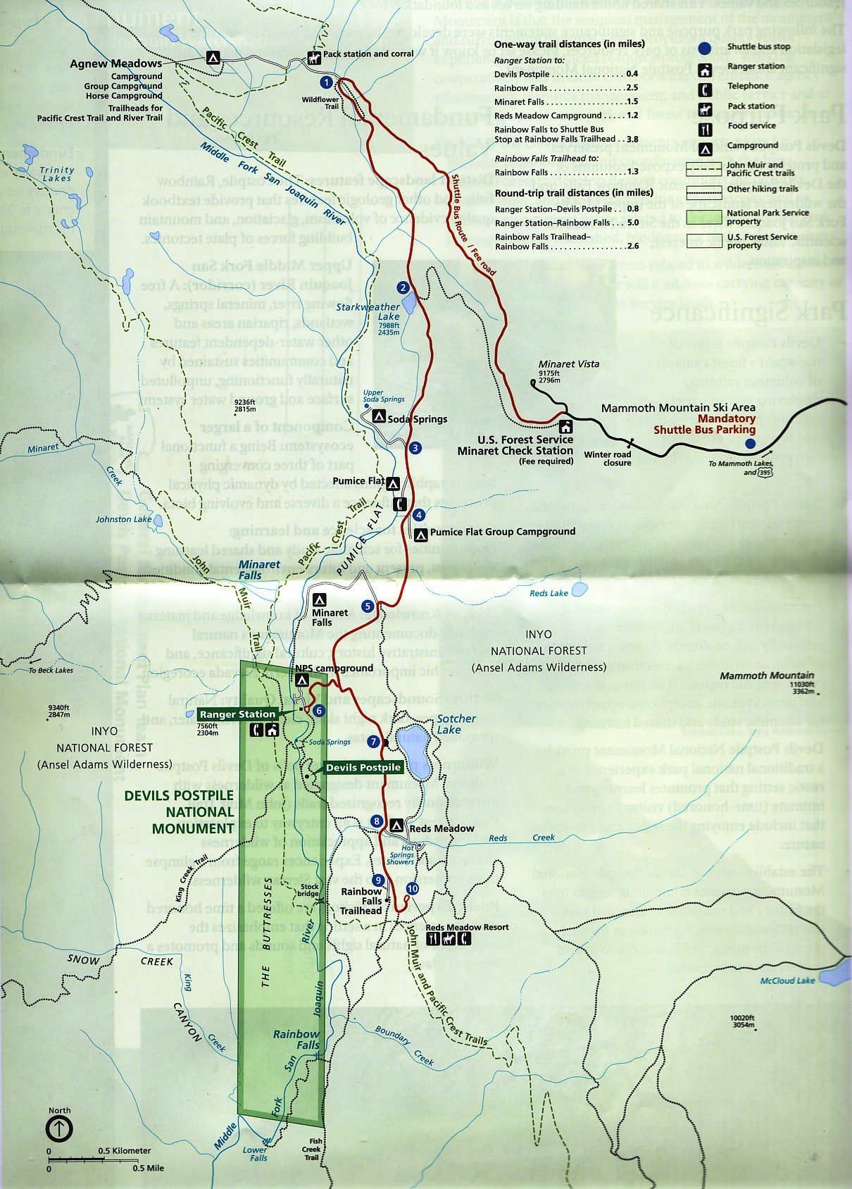
On U.S. 395, drive to Mammoth Junction / Highway 203. Turn west on Highway 203 and drive four miles, through the town of Mammoth Lakes to the traffic light at Minaret Road. Turn right and drive five miles to Minaret Station. (You'll drive through the Mammoth Mountain Ski Resort.) From the pay-station, continue for nine miles to Devil's Postpile. Note: day-use may require parking near the Minaret Station and traveling down via a shuttle bus.
The Middle Fork San Joaquin River originates from Thousand lsland Lake within the Ansel Adams Wilderness at an elevation of 9,834 ft. It flows 8.75 miles inside Inyo National Forest in a southerly direction through a moderately steep glacial valley to enter Devils Postpile National Monument at 7,600ft. The river then flows south past the Devils Postpile formation. After 3.7 miles the river exits the Monument at 7,200 ft.
The flow pattern of the Upper Middle Fork mirrors other streams in the Sierra Nevada, with peak run-off in late May through June. Peaks of just over 500 CFS are average during run-off, and drop off to under 100 CFS within a couple of weeks. In the past five years, however, peak runoff rarely jumped the 200 CFS bar, and dropped quickly below 100 CFS by early June.
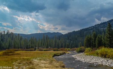
The Middle Fork flows nine miles within Inyo National Forest through a small glacial valley until reaching Devils Postpile National Monument. The river runs south near the base of the Postpile and exists the Monument after a short four mile run. I like to think of the fishing and access points along these lines: (1) Devils Postpile - Ranger Station to Lower Falls, (2) Campgrounds – Minaret Falls to Soda Springs, and (3) Ansel Adams Wilderness - Agnew Meadows to Shadow Lake Trail Junction (off the River Trail).
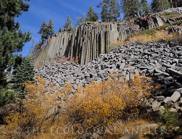
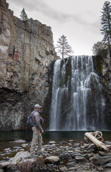
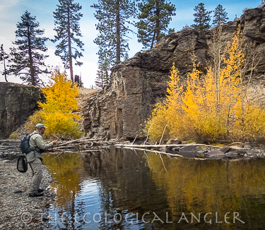
To fish the “Devils Postpile section,” you’ll want to park at the Monument’s Ranger Station / Visitor Center. Warning: this is the launch point for the area’s main geologic attraction and park’s namesake - “Devils Postpile.” A short hike parallel’s the river to the uniform columns of rock. Since most folk come for the rock formation, the nearby river gets completely ignored. That’s not so say, a few people won’t stray down or even another angler might be plying the water. In fact, you should expect company within a mile radius of the Postpile. That’s also not to suggest, you should avoid fishing it. The river meanders though a wide valley floor above and just below the Postpile. I’ve hooked a number of wild brown trout in here. Given the slow and clear flows, correctly presenting the right sort of bug to these browns can be as challenging as finding parking, but ultimately worth it.
Trout densities were estimated by population surveys in 1986, 1987, 1988, and 1991 (Deinstadt et. Al I995). Densities ranged from 2,508 fish per mile at the arch bridge, to 11,133 fish per mile near the Ranger Station. Between Rainbow Falls and Lower Falls, rainbow trout constituted 69% of the 1987 sample and 63% of the 1988 sample. Brown trout made up the majority of the samples in the rest of the river, while brook trout were present in low numbers throughout.
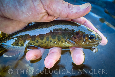
Mean densities of brown, rainbow, and brook trout populations were 3,442, 1,831, and 182 fish/mile. Mean abundance of trout larger than six inches for 1986, 1987, 1988, and 1991 was 2,079 fish/mile. Of these, 75% were brown, 23% rainbow, and 2% brook trout. Golden trout were not encountered. Unusually high brown trout densities occur near the Ranger Station in the meandering channels found in the flatter meadow sections. This abundance probably relates to habitat preference.
Low water during drought periods may increase brown trout production and decrease rainbow trout production (Deinstadt 1994). Estimated wild trout biomass during four surveys from 1986 to 1991 ranged from 62.6 to 214.8 Ibs./acre. Average standing crops of brown, rainbow, and brook trout were 85.4, 22.9 and 2.1Ibs./acre respectively. When comparing the 1987, 1988 and 1991 trout population data with other west slope Sierra trout streams the Middle Fork San Joaquin ranks second in total trout density, third in biomass, and first in the number of six inch and larger trout per mile.