Directions
From Manteca
Manteca is located off of Highway 99 - between Stockon to the North and Modesto to the South. From Manteca take Highway 120 for 111 miles until you reach Tuolumne Meadows inside Yosemite National Park. Day use parking is available at various locations off Highway 120 in Tuolumne Meadows, and overnight camping is also available at the Tuolumne Meadows Campground.
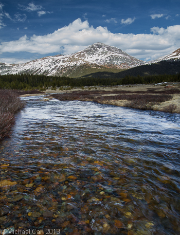
Dana Fork of the Tuolumne River
The Tuolumne River originates from two forks - the Dana Fork and the Lyell Fork. These two forks form the headwaters of the Tuolumne. Along the Dana Fork the trout are small and wild, and the views are expansive and dramatic. Some of these views from the Dana Fork include glacially carved mountains and ridgelines, and of course, alpine and subalpine meadows. As you fish near the banks of the Dana Fork, the Kuna Crest, Mount Dana, Mount Gibbs, and the meandering Dana Fork will stay firmly in your memory long after leaving the area.
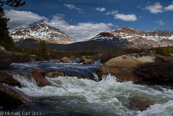
These two forks meet in Tuolumne Meadows and continue a slow, steady meander before plunging and cascading over large rock faces down to Glen Aulin and on to the Grand Canyon of the Tuolumne River. As seen from Tuolumne Meadows (8,600 feet in elevation), the Tuolumne and a large portion of the lower Dana Fork provide a classic alpine-stream fishery.
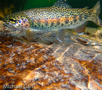
The Dana Fork fishery consists primarily of wild rainbow and brown trout in the 6 to 12 inch range. The clarity of the water and the table-top-like-smoothness of the surface make approaches to these fish far more critical than what you present them with. Keep a fair distance from the water and look for water holding trout, then pick a spot to cast/drift your fly from. Given a short growing season and limited populations of insects, these fish are eager to take a well presented offering.
Not Even Flows
Early in the snow-melt season, the Lyell and Dana Forks contribute about 60 percent and 40 percent of the flow beneath the Tioga Road bridge in Tuolumne Meadows, respectively, proportions comparable to their relative drainage areas. As the melt season continues in mid-summer and snow cover decreases, the Lyell Fork contributes a greater fraction (66-75%) of the total flow into Tuolumne Meadows (Lundquist et al. 2005).